Outdoor recreation is not only a quality of life issue in the Upper Arkansas River Valley, but a financial engine that fuels the local economy.
With the closure of the Climax Mine in the early 1980’s and the loss of over 3,000 jobs and almost 80 percent of its assessed value, Lake County learned the painful lesson of having all of their eggs in one basket. The remoteness and rugged terrain inherent to its position at 10,000 feet along the Continental Divide were, at once, an asset and a liability in the effort to diversify the economic base. Outdoor recreation was one area where the mountain environment provided a competitive edge in the tourism industry, making it an obvious target for economic development efforts.
The premise of Open Space is to limit infrastructure development in order to retain natural resource and intrinsic values.
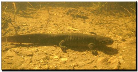
The Lake County Initiative Ecosystem Management Plan, therefore, emphasizes dispersed, non-vehicular forms of recreation on the subject properties, such as fishing, hunting, hiking, wildlife watching, photography, horseback riding, and mountain biking. The Management Direction in the Plan includes improving non-vehicular access to the Arkansas Headwaters Recreation Area, maintaining or improving hunting and fishing access, limiting mechanized recreation to sustainable trail surfaces, and controlling commercial recreational uses of the properties.
Prior to the inception of LCOSI, virtually all access to the Arkansas River in Lake County was located on private lands. Although Lake County is the headwaters of the Arkansas River, the Arkansas Headwaters Recreation Area (AHRA), which extends for 150 miles from Fremont Pass to Pueblo Reservoir, offered no public access to the river in Lake County prior to the formation of LCOSI. Land acquisitions, conservation easements, and stewardship trust agreements through the Initiative have opened public access to approximately 10 miles of the River, and extended AHRA recreational management into Lake County.
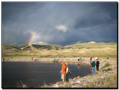
LCOSI also recognized the need for limited developed recreation, including trailheads and parking areas, restrooms, and a jumping off point for dispersed recreation within the Open Space. The Hayden Meadows Recreation Area was planned and funded through LCOSI as the primary portal to the Open Space, using approximately $1.35 million in grant and match funding provided by the partners. Located in a high visibility location along the Top of the Rockies National Scenic and Historic Byway, the 63-acre Recreation Area provides parking, restrooms, handicapped accessible interpretive trails, and a central jumping off point for the 7 miles of stream fishing passing through the Open Space.
The facility includes a 7-acre stocked pond with a handicap accessible fishing peninsula, encircled by a half mile of ADA accessible interpretive trail including information kiosks, low profile wayside exhibits, wetland boardwalks, and a wildlife observation platform. The park was donated to Lake County in 2001 to add to its recreational portfolio.
The 5-mile long High Lonesome Trail Loop, paralleling both sides of the river between the Hayden Meadows Recreation Area and the Kobe River Access Portal, was opened to the public in the fall of 2014.